The cool weather for this time of year will continue in the north until Thursday, with maximum temperatures mostly remaining in the single digits and a risk of frost in the morning. On Friday, double-digit maximums are expected for the first time in almost 10 days. At the weekend, it should then become very mild to warm with a foehn-like southerly current over the Alps, and the long cool phase will then definitely be over.

Very cool start to the week
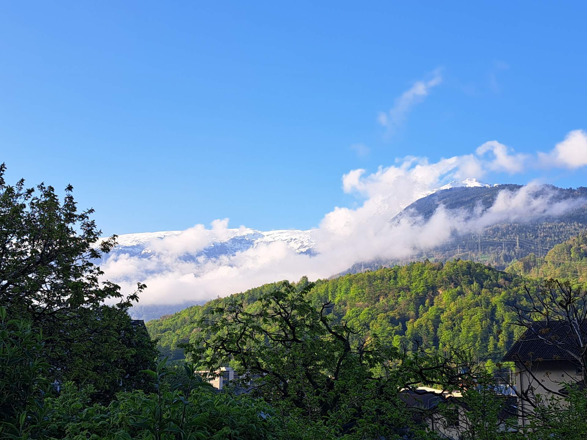
The week got off to a cold start with light frost, especially in the west, widespread ground frost and localized snow cover at low altitudes(see here and Fig. 1). There has also been a lot of snow in the northern Alps in the last few days, with the webcams showing high winter conditions (see Fig. 2).

Fig. 1: In Zug, for example, it was slightly sugary this morning; Source: roundshot
")
Fig. 2: There has been a lot of fresh snow in the northern Alps in the last few days (Wildspitz 1580 m); Source: roundshot
Today's Monday will now bring lots of clouds throughout the day in German-speaking Switzerland and occasional precipitation in the lowlands, more frequent precipitation along the Alps with snow from around 400 to 700 meters. Especially in the morning, it will snow down to the lowlands. With a weak to moderate Bise, temperatures will only reach around 5 to 7 degrees. Not only in the north, but also in the south there will be a lot of clouds today and especially in southern Ticino some precipitation with flakes from around 600 to 900 meters, at around 8 to 9 degrees. In the west, the weather will be somewhat friendlier, with some sunshine, but a strong Bise at around 7 to 9 degrees. In the lowlands, at most isolated drops and flakes are possible at slightly higher altitudes (see Fig. 3).

Fig. 3: Weather today Monday; Source: MeteoNews
Tuesday remains very cool
Tomorrow, Tuesday, there will be little change in the weather, the Bise or the temperatures. It will remain mostly cloudy in German-speaking Switzerland with repeated precipitation, especially in the foothills of the Alps, while in the west there will be at most little precipitation and some clearing. As today, snow will fall from around 400 to 700 meters, with flakes possible in the lowlands and Alpine valleys, especially in the morning. In the south, little precipitation is expected at most, but it will remain mostly cloudy. Temperatures will reach around 5 to 7 degrees in the east, 7 to 9 degrees in the west and 11 to 12 degrees in the south. In the morning, light frost is possible locally in the north.
Wednesday and Thursday a touch less chilly
On Wednesday and Thursday, especially in the lowlands, some clearing and a few rays of sunshine can be expected, but the tendency to showers is still somewhat increased. Along the Alps, on the other hand, hardly any clearing is to be expected, and here it will be wet again and again with snow mostly from around 500 to 1000 meters. Temperatures will be slightly lower than today and tomorrow, but still well below average for the time of year at 7 to 9 degrees, with light frost still possible in places in the morning. Things look better in the south, especially on Wednesday, with plenty of sunshine and mild temperatures of 16 degrees. Thursday will be changeable with possible isolated showers and somewhat cooler.
Friday with widespread double-digit maximums
The exact weather development on Friday is still uncertain, but it is likely to be a mostly dry and milder mix of sun and cloud with a shift in the high winds to the southwest, and possibly also quite sunny. Temperatures will exceed the 10-degree mark for the first time since April 16 and thus for the first time in almost 10 days, with between 10 and 15 degrees depending on the weather model. Light frost is possible again locally in the morning. The south, on the other hand, is likely to be more affected by moisture, so there will probably be precipitation and little sunshine at most.
Weekend very mild to warm
At the weekend, it is not clear where exactly a high pressure low will be located. However, it is likely to be located over Western Europe, so that a foehn-like southerly current will develop over the Alpine region, bringing very mild to warm air to the north of the Alps and bringing the cool phase to an end. With partly sunny weather, especially in German-speaking Switzerland, temperatures could well reach or even exceed 20 degrees, especially in the Föhn valleys. In the south, on the other hand, there will probably be a lot of clouds in the southern congestion and it will also be wet at times and less warm than in the north.
Finally, an overview of the weather development from tomorrow Tuesday to next Sunday (see Fig. 4).

Fig. 4: Weather outlook from tomorrow Tuesday to Sunday; Source: MeteoNews
disclaimer
The content of this article has been at least partially computer translated from another language. Therefore, grammatical errors or inaccuracies are possible. Please note that the original language version of the article should be considered authoritative.