


weather Switzerland
Still cool in the north until the middle of next week
The current cool and unsettled phase with recurring showers will continue in the north until around the middle of next week, with maximum temperatures mostly reaching only 7 to 10 degrees and snow often falling from 500 to 1000 meters. In the south, it will be partly to quite sunny and much milder until Sunday, but then, as in the north, it is likely to be unsettled and partly wet, especially on Monday, until the middle of the week. This will further reduce the temperature surplus in April, which has already dropped significantly compared to mid-month.

bioweather Switzerland
An ever earlier spring – good or bad? Increased frost risk!
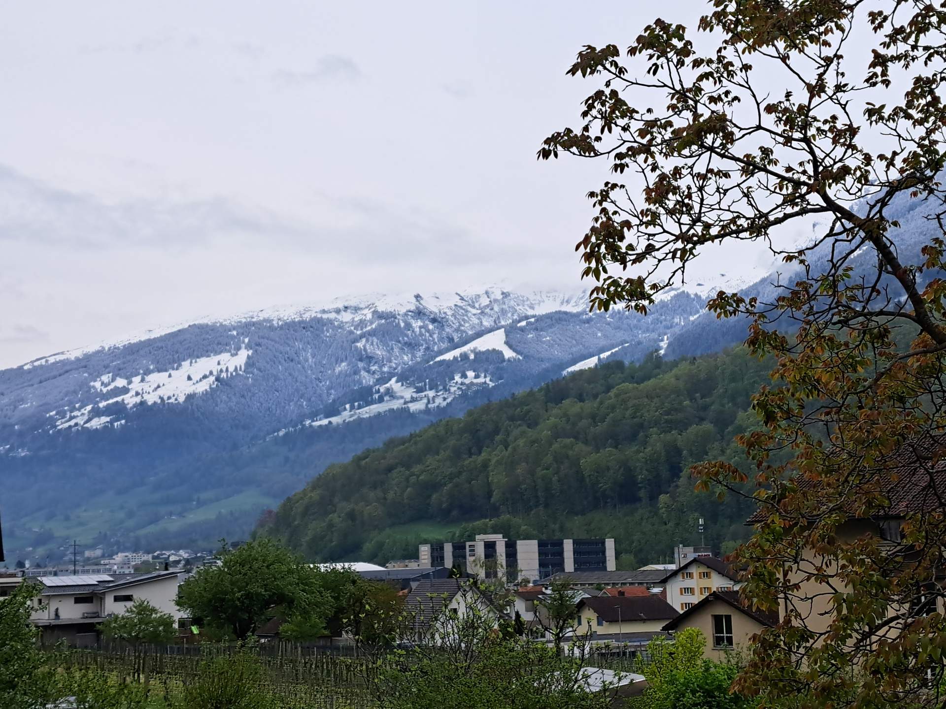
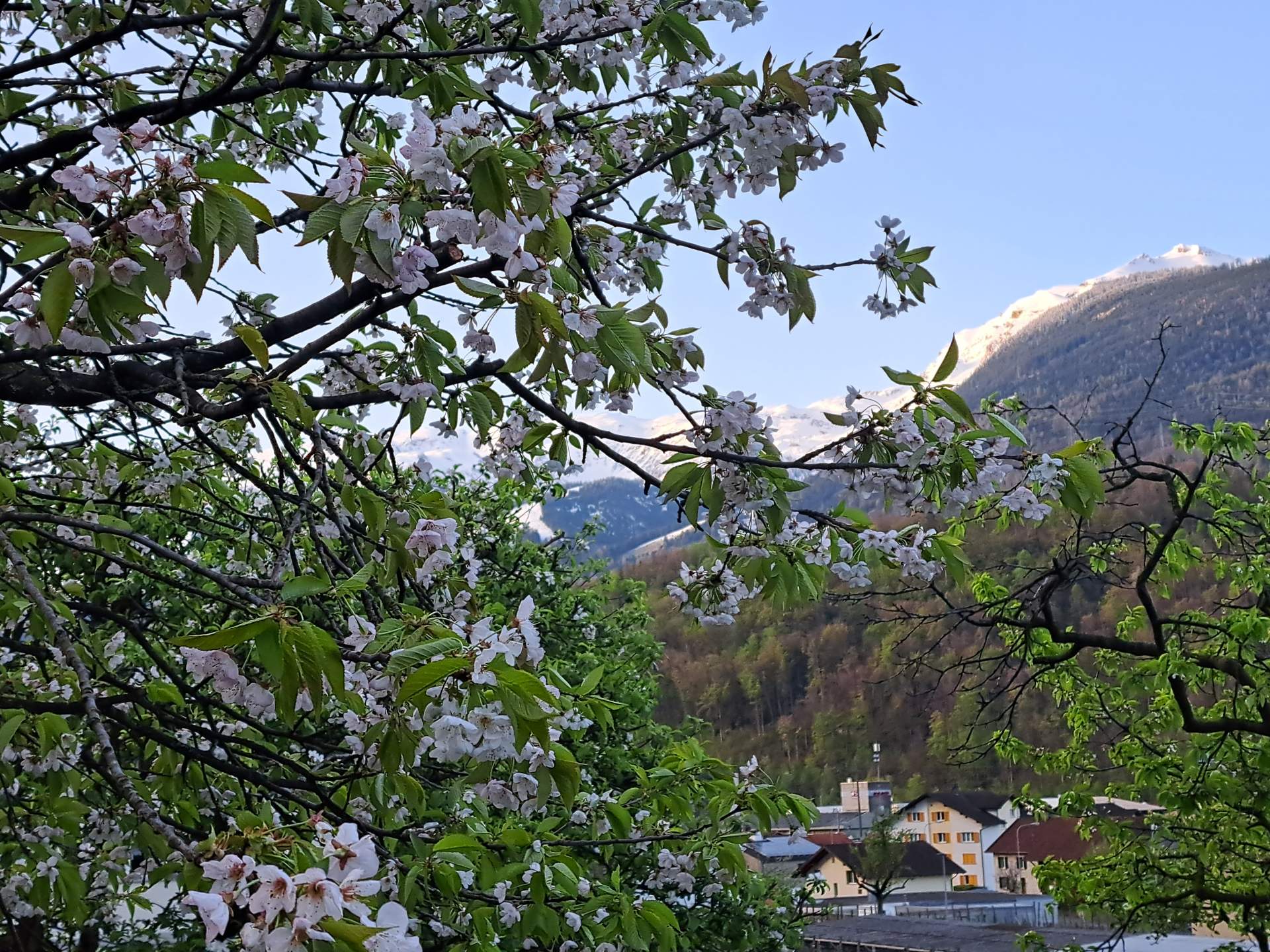
One of the mildest winters on record and the exceptionally mild spring so far are having an impact on nature: as has often been the case in recent years, it has awoken very early and is currently two to four weeks ahead of the rest of the year. Winters are becoming milder and milder as a result of climate change, which means that nature is waking up earlier and earlier and the growing season is being extended. This has a variety of effects, both positive and negative. In particular, the risk of late frosts causing damage is increasing. The next few days will be tricky in this respect.

weather lexicon
Sleet – Styrofoam balls from the sky
In the winter months, but especially in the transition phase from the cold to the warm season, you can always read about sleet showers in the weather reports. But what exactly is sleet and how does it differ from the better-known hail or snow?

weather international
Exceptional rainfall in the Emirates
After the unprecedented floods of February 12 (37 mm), the northern United Arab Emirates are set to experience another exceptional downpour this Tuesday, April 16, but on a much larger scale. Various weather models are forecasting local rainfall totals in excess of 100 mm, almost double the region's annual rainfall.

climate Switzerland
The first half of April was almost 5 degrees too warm!
The first half of April was exceptionally warm, with an excess of almost 5 degrees over the whole of Switzerland! There were also an unusually large number of summer days and even all-time April temperature records in some places. There were big differences in terms of precipitation: in the south it was sometimes far too wet, on the Swiss Plateau on the other hand, it was usually far too dry. The duration of sunshine was roughly within the norm.

weather Switzerland
Cold front heralds changeable and cool phase
After the extremely warm weekend with local April records, the weather situation is gradually changing in the new week. A first cold front will bring showers today (Monday), followed by another cold front next night. This heralds a rather cool and changeable weather phase.

climate international
Still on course for a record in 2024
2023 was the warmest year in recorded history, but so far it has been clearly surpassed by 2024. The first three months seamlessly join a series of now ten consecutive months with record temperatures. The oceans have also never been as warm as they are now since satellite-based observations began.

bioweather Switzerland
Hatschi – pollen season 2024
Later than last year, but much earlier than usual, the pollen season began in the last decade of January with the increased blossoming of hazelnuts and alders, and with it the time of suffering for pollen allergy sufferers in the north. However, the hazel and alder blossom season is now largely over. Instead, the ash and birch pollen season has begun.
weather Switzerland
With High Peter return of warmth – temporarily...
From Thursday to Sunday, sunny and increasingly warmer weather will set in in the area of influence of high pressure system Peter. At the weekend, it will be 23 to 25 degrees in the north and 26 to 27 degrees in the south, already warm again in early summer. In the coming week, it will be changeable, partly windy and increasingly cooler until the middle of the week, with first a westerly and then a northerly flow in the north. In addition, it will often be wet, especially along the Alps, with increasing northern congestion and the snow line dropping below 1000 meters by the middle of the week. The weather will also be changeable and windy next Monday for Sechseläuten in Zurich. In the south, on the other hand, the weather will be quite sunny and still warm from Tuesday with a northerly foehn.

climate international
Atlantic hurricane season 2024 – the first forecasts
As every year, the hurricane season in the Atlantic officially starts on June 1. In the meantime, the first institutes have already published their forecasts for the course of the coming storm season, and they all see a very active course. The reason for this is a combination of two factors that are likely to complement each other almost perfectly this year.