Weather Dom
Forecast
| Saturday20. Apr. | Sunday21. Apr. | Monday22. Apr. | Tuesday23. Apr. | Wednesday24. Apr. | Thursday25. Apr. | Friday26. Apr. | Saturday27. Apr. | Sunday28. Apr. | Monday29. Apr. | |
| 3 hourly | 3 hourly | 3 hourly | 3 hourly | 3 hourly | 3 hourly | 3 hourly | 3 hourly | 3 hourly | 3 hourly | |

|
|

|

|

|

|
|
|
|
||
| weather |

|
|

|
|

|

|

|
|

|

|
| Temperature | -17 °C | -17 °C | -17 °C | -18 °C | -15 °C | -14 °C | -13 °C | -12 °C | -11 °C | -8 °C |
| -18 °C | -21 °C | -23 °C | -22 °C | -23 °C | -23 °C | -20 °C | -18 °C | -15 °C | -11 °C | |
| Sunshine | 3.7 h | 5.0 h | 1.1 h | 2.6 h | 8.1 h | 10.8 h | 8.1 h | 3.4 h | 4.2 h | 6.0 h |
| 25 % | 35 % | 10 % | 20 % | 60 % | 80 % | 60 % | 25 % | 30 % | 40 % | |
| precipitation | 8 - 12 mm | 2 - 3 mm | 4 - 8 mm | 1 - 4 mm | 0 mm | 0 mm | 0 mm | 0 mm | 0 mm | 1 - 2 mm |
| 100 % | 95 % | 95 % | 95 % | 0 % | 0 % | 5 % | 10 % | 5 % | 40 % | |
| Wind |
20 km/h
|
15 km/h
|
15 km/h
|
10 km/h
|
10 km/h
|
10 km/h
|
10 km/h
|
15 km/h
|
20 km/h
|
25 km/h
|
| 60 km/h | 40 km/h | 40 km/h | 30 km/h | 35 km/h | 25 km/h | 30 km/h | 40 km/h | 40 km/h | 35 km/h | |
| Freezing level | 1100 m | 900 m | 1000 m | 1200 m | 1300 m | 1600 m | 1900 m | 2100 m | 2500 m | 3100 m |
| UV index | 6 | 5 | 4 | 6 | 10 | 8 | 7 | 6 | 6 | 7 |


Forecasts Valais
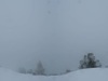
Rain arriving from the north in the evening, possibly quite frequent until mid-night. Precipitation then tapering off towards the end of the night. Snow limit initially around 1000 m, then dropping to 700 m by the end of the night.
Saturday: changeable weather. Some fine sunny spells over the Rhône plain during the day. Isolated showers or sleet still possible at times until late afternoon, mainly in the mountains on the right bank of the Rhône. Limit of flakes around 500-600 m in the morning, then 700-900 m thereafter. Very cool.
Temperatures expected on the Rhône plain: lows 3° to 5°, highs 9° to 11°. In stations around 1500m: lows -3 to -1°, highs 1 to 3°. On the summits: -6/-4° at 2000m, -13/-11° at 3000m. Isotherm of 0°: 1200 m.
Significant wind during the day on the Rhône plain. Very strong northerly wind in the high mountains (peak winds sometimes exceeding 70 km/h at around 2500m).
(MeteoNews, 19 April, 4 pm)Nicolas Borgognon; Friday, 19. April 2024, 16 Uhr
Next few days in Valais
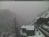
Sunday, cloudy in the morning, then more changeable skies in the afternoon and clear spells developing. A few showers or sleet may occur regionally, mainly in the mountains. Snowfall limit around 600 to 700 m. Temperatures not exceeding 10°.
From Monday to Thursday, continuing changeable and unseasonably cool conditions (highs around 10°). A few drops possible at times, mainly near the higher ground (flakes from 700-800 m). There will also be moments of sunshine in the lowland areas, particularly on Wednesday morning.
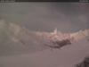
From Friday onwards, there may be a change in the weather pattern, with south to south-westerly winds at higher altitudes and a gradual rise in temperatures. However, this development is as yet unreliable.Nicolas Borgognon; Friday, 19. April 2024, 16 Uhr
Sun
Moon
Dom, 20. April 2024
Dom
| other name | Monte Dom, Dom des Mischabel |
| country |
 Switzerland Switzerland
|
| canton | Valais |
| Altitude | 4545 a.s.l. |
| coordinates | 46° 5.6' N 7° 51.5' E |