- Europe
- Weather Switzerland
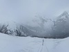
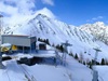
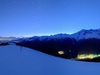
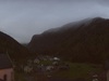
- Le Tour Noir
Weather Le Tour Noir
Forecast
| Thursday25. Apr. | Friday26. Apr. | Saturday27. Apr. | Sunday28. Apr. | Monday29. Apr. | Tuesday30. Apr. | Wednesday1. May | Thursday2. May | Friday3. May | Saturday4. May | |
| 3 hourly | 3 hourly | 3 hourly | 3 hourly | 3 hourly | 3 hourly | 3 hourly | 3 hourly | 3 hourly | 3 hourly | |

|

|

|
|

|

|
|
|
|
||
| weather |

|

|

|
|

|
|

|

|
|
|
| Temperature | -11 °C | -11 °C | -9 °C | -7 °C | -6 °C | -7 °C | -7 °C | -7 °C | -8 °C | -9 °C |
| -19 °C | -15 °C | -12 °C | -9 °C | -11 °C | -7 °C | -8 °C | -7 °C | -9 °C | -10 °C | |
| Sunshine | 12.8 h | 2.3 h | 0.7 h | 0.1 h | 2.5 h | 0.1 h | 0.1 h | 0.4 h | 0.0 h | 0.1 h |
| 90 % | 15 % | 5 % | 0 % | 20 % | 0 % | 0 % | 0 % | 0 % | 0 % | |
| precipitation | <1 mm | 3 - 6 mm | 6 - 11 mm | 20 - 25 mm | 0 - 1 mm | 15 - 20 mm | 25 - 30 mm | 5 - 8 mm | 20 - 30 mm | 8 - 13 mm |
| 50 % | 100 % | 95 % | 95 % | 40 % | 90 % | 90 % | 85 % | 85 % | 80 % | |
| Wind |
15 km/h
|
15 km/h
|
25 km/h
|
35 km/h
|
30 km/h
|
30 km/h
|
30 km/h
|
15 km/h
|
15 km/h
|
20 km/h
|
| 55 km/h | 35 km/h | 75 km/h | 80 km/h | 75 km/h | 75 km/h | 80 km/h | 40 km/h | 45 km/h | 35 km/h | |
| Freezing level | 1300 m | 1700 m | 1900 m | 2400 m | 2500 m | 2600 m | 2600 m | 2500 m | 2400 m | 2200 m |
| UV index | 6 | 6 | 5 | 4 | 8 | 5 | 4 | 6 | 3 | 3 |

Forecasts Valais
This evening and tonight, variable weather with a few showers on the higher ground. Cool temperatures and flakes from 800 to 1000m altitude and risk of frost on the ground until the plains in the second half of the night.
Thursday: cloudy residues in the early hours, giving way to sunny skies in the morning, continuing in the afternoon with a few cumulus clouds. Cool temperatures with a risk of frost until the lowlands at dawn.
Temperatures forecast for the Rhône plain: lows 0 to 2°C, highs 12 to 15°C. In stations around 1500m: lows -6 to -4°, highs 4 to 6°. On the summits: -6/-2° at 2000m, -14/-10° at 3000m. Isotherm of 0°: 1900m.
Light to moderate breezes on the plains and in the valleys, moderate westerlies in the high mountains.
(MeteoNews, 24 April, 15:30)Vincent Devantay; Wednesday, 24. April 2024, 15 Uhr
Next few days in Valais
Friday will be cloudy to overcast, but generally dry. Temperatures fairly cool for the season, with highs of 13 to 15 degrees in the lowlands and 5 to 7 degrees around 1500m altitude.
Saturday will see widespread cloudy spells and even sunny spells, but the foehn will keep the weather dry. Seasonal temperatures with highs of 16 to 18 degrees in the lowlands and 10 to 12 degrees around 1500m altitude. Cloudy and rainy in the Simplon region.
Sunday, changeable but dry thanks to the foehn, with often widespread cloudy spells. Seasonal temperatures with highs of 16 to 18 degrees in the lowlands and 10 to 12 degrees around 1500m altitude. Cloudy and rainy in the Simplon region.
Monday and Tuesday: fairly sunny and generally dry. Mild and pleasant temperatures during the day, with highs around 20 degrees in the lowlands and around 15 degrees at altitudes of 1000m.Vincent Devantay; Wednesday, 24. April 2024, 15 Uhr

Sun
Moon
Le Tour Noir, 25. April 2024
Le Tour Noir
| other name | Tour Noir |
| country |
 Switzerland Switzerland
|
| canton | Valais |
| Altitude | 3836 a.s.l. |
| coordinates | 45° 56.9' N 7° 2.2' E |