- Europe
- Weather Switzerland
- Aletschhorn
Weather Aletschhorn
Forecast
| Tuesday16. Apr. | Wednesday17. Apr. | Thursday18. Apr. | Friday19. Apr. | Saturday20. Apr. | Sunday21. Apr. | Monday22. Apr. | Tuesday23. Apr. | Wednesday24. Apr. | Thursday25. Apr. | |
| 3 hourly | 3 hourly | 3 hourly | 3 hourly | 3 hourly | 3 hourly | 3 hourly | 3 hourly | 3 hourly | 3 hourly | |

|

|

|
|
|

|
|

|
|
||
| weather |

|

|
|
|
|

|

|
|

|
|
| Temperature | -16 °C | -15 °C | -17 °C | -16 °C | -16 °C | -16 °C | -15 °C | -15 °C | -16 °C | -15 °C |
| -16 °C | -16 °C | -19 °C | -22 °C | -18 °C | -21 °C | -22 °C | -21 °C | -22 °C | -19 °C | |
| Sunshine | 1.9 h | 1.0 h | 2.6 h | 0.7 h | 0.6 h | 6.4 h | 4.2 h | 7.2 h | 1.1 h | 1.0 h |
| 15 % | 10 % | 20 % | 5 % | 5 % | 45 % | 30 % | 50 % | 10 % | 5 % | |
| precipitation | 9 - 12 mm | 20 - 30 mm | 9 - 14 mm | 14 - 15 mm | 15 - 20 mm | 3 - 5 mm | 1 - 3 mm | 1 mm | 1 - 3 mm | 8 - 13 mm |
| 100 % | 100 % | 95 % | 95 % | 95 % | 90 % | 60 % | 40 % | 85 % | 85 % | |
| Wind |
35 km/h
|
30 km/h
|
25 km/h
|
30 km/h
|
35 km/h
|
25 km/h
|
20 km/h
|
15 km/h
|
20 km/h
|
15 km/h
|
| 90 km/h | 70 km/h | 65 km/h | 80 km/h | 80 km/h | 60 km/h | 60 km/h | 40 km/h | 40 km/h | 40 km/h | |
| Freezing level | 1400 m | 1000 m | 800 m | 1200 m | 1100 m | 900 m | 900 m | 1100 m | 1200 m | 1200 m |
| UV index | 6 | 6 | 5 | 5 | 7 | 8 | 7 | 8 | 7 | 5 |
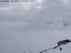
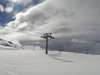
Webcams


Forecasts Valais
This Tuesday, very cloudy weather in the early morning with a few showers. Snow limit close to 1200m. Otherwise, the weather will improve and clear skies will develop over lowland areas. Risk of showers increasing again in the evening and overnight (flakes from 600 to 800m). Cool and windy.
Temperatures forecast for the Rhône plain: lows 8 to 9°C, highs 12 to 13°C. In resorts around 1500m: lows 1 to 3°, highs 3 to 5°. On the summits: -1/3° at 2000m, -9/-9° at 3000m. Isotherm of 0°: 1500 m.
Significant wind during the day on the Rhône plain (gusts around 50 km/h). Strong easterly wind in the high mountains (gusts sometimes exceeding 65 km/h at around 2500m).
(MeteoNews, 16 April, 6.00 am)Vincent Devantay; Tuesday, 16. April 2024, 6 Uhr
Next few days in Valais
On Wednesday, heavy skies in the first part of the day and showers or sleet possible in all regions. Snowfall limit at 600 to 700 metres. Tendency towards clear skies in the afternoon, sometimes fine in the Rhône plain. Areas of showers and sleet again the following night, giving snow up to around 500 to 600 m. Very cool.
Thursday, changeable to cloudy, with showers and sleet still possible in all regions, but mainly in the morning. A tendency to clear in the afternoon. The weather will be particularly cool for the time of year, with the limit of flakes reaching around 500 to 600 metres at daybreak.
Friday, brief improvement in the morning, then a rapid increase in cloud cover from the north-west, and the passage of a disturbance between the evening and the following night. Precipitation likely in all regions. Snow limit between 800 and 1000 m. Still cool.
Trend for the weekend ahead: rising pressure from the west, but continuing generally changeable and unseasonably cool weather. A few showers or sleet are not out of the question, mainly near the higher ground. There will also be some fine sunny spells over the lowlands.Vincent Devantay; Tuesday, 16. April 2024, 6 Uhr
Sun
Moon
Aletschhorn, 16. April 2024
Aletschhorn
| country |
 Switzerland Switzerland
|
| canton | Valais |
| Altitude | 4193 a.s.l. |
| coordinates | 46° 27.9' N 7° 59.6' E |