climate Switzerland
All about snow in April
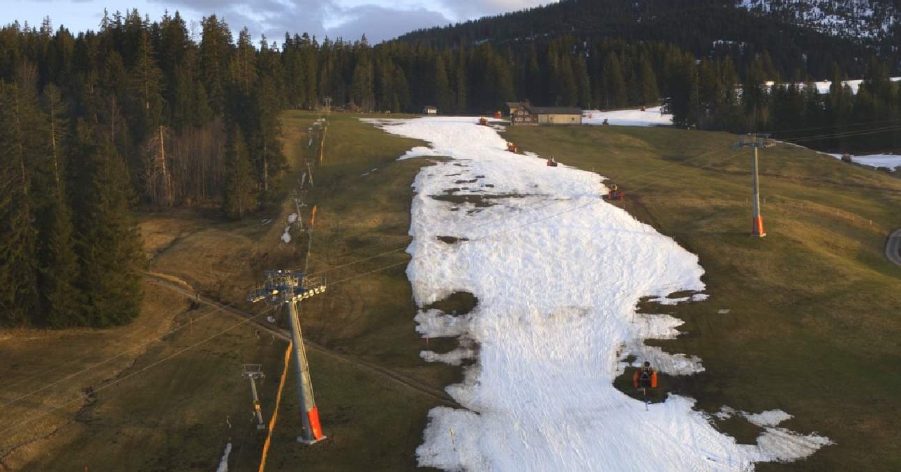
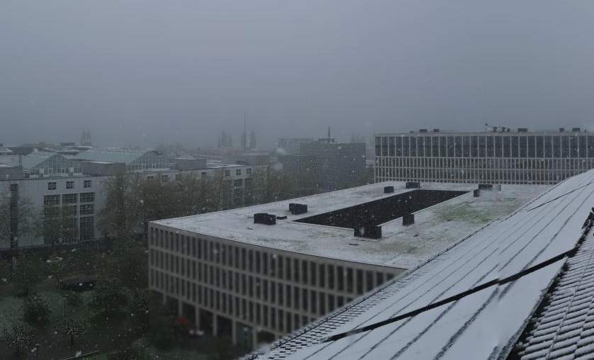
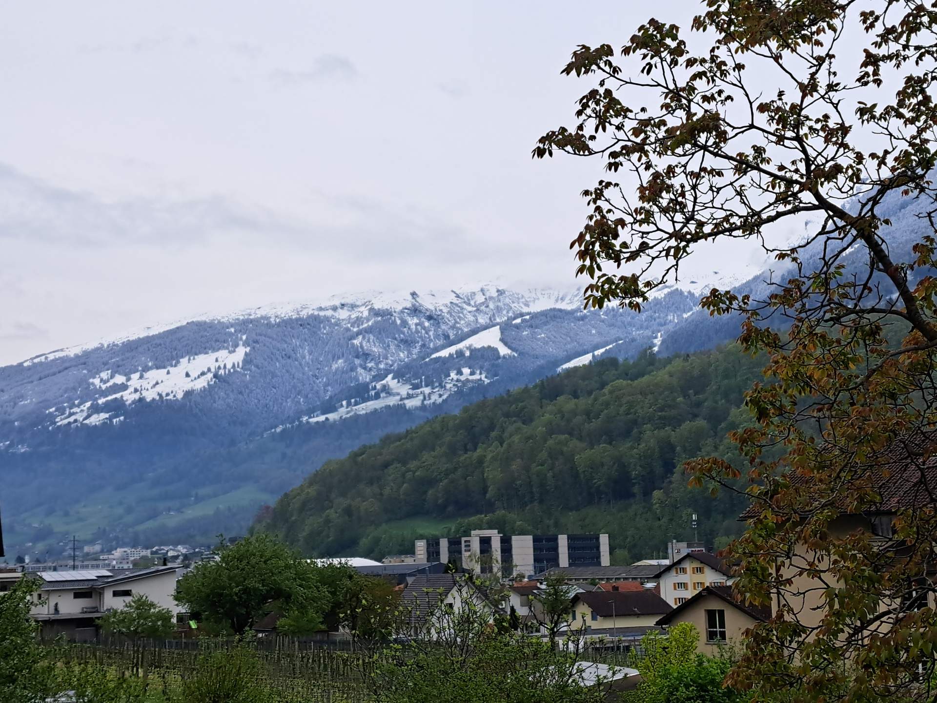
April did what it wanted this year, with snow down to low altitudes in the last few days. Snow in April occurs from time to time in the lowlands (on average about once or twice), but mostly in the first half of April. In addition, after a winter that was too wet in the Alps and a spring that has been too wet so far, there is currently much more snow than normal at high altitudes. This is certainly positive for the water balance in summer. The initial situation is also good for the glaciers, but the balance will depend heavily on the weather conditions in the summer.

bioweather Switzerland
An ever earlier spring – good or bad? Increased frost risk!
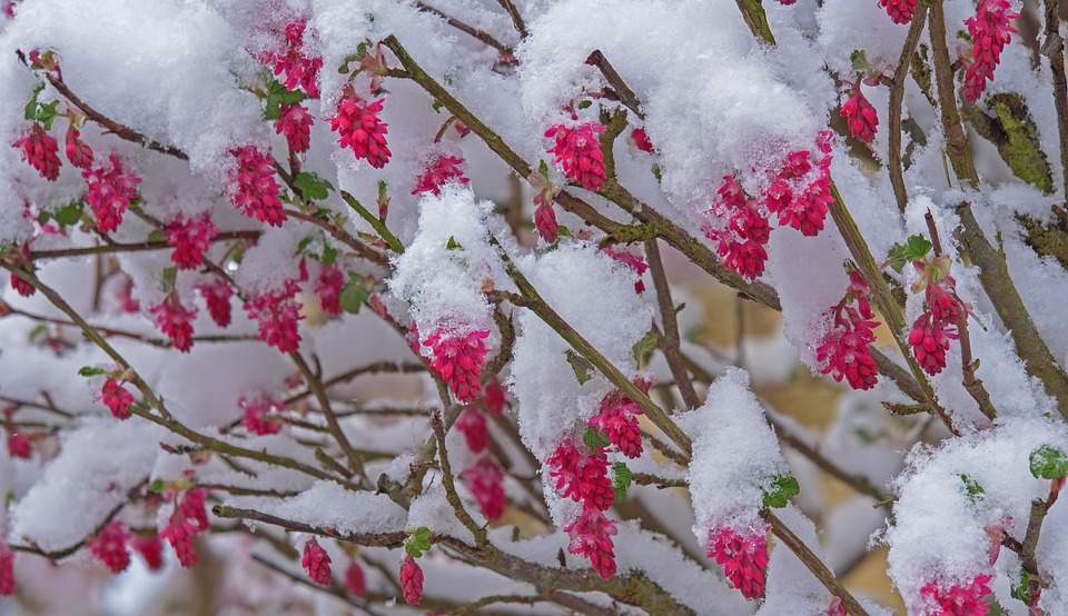
One of the mildest winters on record and the exceptionally mild spring so far are having an impact on nature: as has often been the case in recent years, it has awoken very early and is currently two to four weeks ahead of the rest of the year. Winters are becoming milder and milder as a result of climate change, which means that nature is waking up earlier and earlier and the growing season is being extended. This has a variety of effects, both positive and negative. In particular, the risk of late frosts causing damage is increasing. The next few days will be tricky in this respect.

climate international
El Niño goes, La Niña comes
El Niño conditions have prevailed in the equatorial Pacific in recent months, and sea surface temperatures here are still above average at present. However, the El Niño is in its final stages and the ENSO swing is tipping.
weather Switzerland
Still cool until Thursday, warmer at the weekend
The cool weather for this time of year will continue in the north until Thursday, with maximum temperatures mostly remaining in the single digits and a risk of frost in the morning. On Friday, double-digit maximums are expected for the first time in almost 10 days. At the weekend, it should then become very mild to warm with a foehn-like southerly current over the Alps, and the long cool phase will then definitely be over.
weather Switzerland
Still cool in the north until the middle of next week
The current cool and unsettled phase with recurring showers will continue in the north until around the middle of next week, with maximum temperatures mostly reaching only 7 to 10 degrees and snow often falling from 500 to 1000 meters. In the south, it will be partly to quite sunny and much milder until Sunday, but then, as in the north, it is likely to be unsettled and partly wet, especially on Monday, until the middle of the week. This will further reduce the temperature surplus in April, which has already dropped significantly compared to mid-month.

weather lexicon
Sleet – Styrofoam balls from the sky
In the winter months, but especially in the transition phase from the cold to the warm season, you can always read about sleet showers in the weather reports. But what exactly is sleet and how does it differ from the better-known hail or snow?

weather international
Exceptional rainfall in the Emirates
After the unprecedented floods of February 12 (37 mm), the northern United Arab Emirates are set to experience another exceptional downpour this Tuesday, April 16, but on a much larger scale. Various weather models are forecasting local rainfall totals in excess of 100 mm, almost double the region's annual rainfall.

climate Switzerland
The first half of April was almost 5 degrees too warm!
The first half of April was exceptionally warm, with an excess of almost 5 degrees over the whole of Switzerland! There were also an unusually large number of summer days and even all-time April temperature records in some places. There were big differences in terms of precipitation: in the south it was sometimes far too wet, on the Swiss Plateau on the other hand, it was usually far too dry. The duration of sunshine was roughly within the norm.

weather Switzerland
Cold front heralds changeable and cool phase
After the extremely warm weekend with local April records, the weather situation is gradually changing in the new week. A first cold front will bring showers today (Monday), followed by another cold front next night. This heralds a rather cool and changeable weather phase.

climate international
Still on course for a record in 2024
2023 was the warmest year in recorded history, but so far it has been clearly surpassed by 2024. The first three months seamlessly join a series of now ten consecutive months with record temperatures. The oceans have also never been as warm as they are now since satellite-based observations began.